Here are a set of maps and mapping tools and toys that are all in various levels of collaborative development.Please use the feedback form to help us improve and of the tools and we will give you collaborative credit for your implemented suggestions and appreciate your positive feedback and encouragement to continue.

Thumbnail 1
LSU Community Alerts
Thumbnail 2
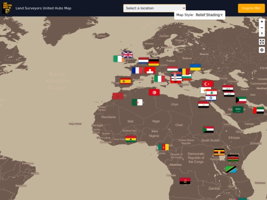
Surveying Visualization
Thumbnail 3
Surveying Blog
Thumbnail 4
GeoRadio
Thumbnail 5
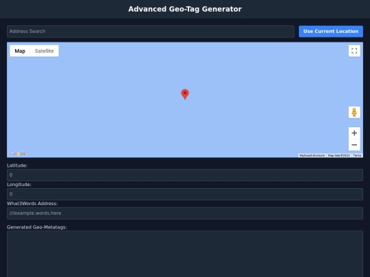
Advanced GeoMetatag generator
Thumbnail 6
Surveyor Drive By
Thumbnail 7
Point Logger
Thumbnail 7
Local

Button Pushers beware, the tools in this shed are meant for CHECKING YOUR WORK and never doing your work. The following tools are intended to help you check your work before handing it in to the big boss. With that said, here are a set of maps and mapping tools and toys that are all in various stages of collaborative development.Please use the feedback form to help us improve. For any of the tools and we will give you collaborative credit for your implemented suggestions and appreciate your positive feedback and encouragement to continue.

Thumbnail 7
Audio Tool
Thumbnail 7
Angle Calculator
Thumbnail 7
Coordinates System Converter
Thumbnail 7
Compass Surveying
Thumbnail 7
Coordinate Offset
Thumbnail 7
Coordinates System Converter
Thumbnail 7
Coordinate Transformation
Thumbnail 7
Curvature Correction
Thumbnail 7
Curve Calculator
Thumbnail 7
Dual Map Generator
Thumbnail 7
Elevation Level Loop
Thumbnail 7
Ellipse Error
Thumbnail 7
Feet to Meters
Thumbnail 7
Equipment Market
Thumbnail 7
Equipment Deals
📈
Equipment Specials
🧰
Field Kit
🌍
Geodetic Computations
🌎
Geoid Undulation
🧭
Grid Azimuth
📏
Height Calculator
Intersection Calculator
📐
Irregular Parcel Calculator
📜
Legal Descriptions
🖋️
Legal Description Writer
📏
Scale Factor
🔄
Three Point Resection Tool
🔧
Traverse Adjustment
🌐
Traverse Network Adjustments
📏
Trigonomic Levelling Calculator
Vector Components
🧰
Vendor Toolkit
📊
Vertical Curve Calculator
🎥
Video Studio
×
×
×